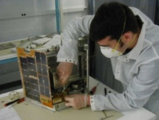
NIUSAT
NIUSAT is a 15-Kilogram Nanosatellite developed at Noorul Islam University with the objective of creating a new modular small satellite platform for a variety of applications. Carrying a Miniature Wide Field Sensor (MWiFS) and Ocean Color Monitor (MOCM) to capture medium-resolution imagery, NIUSAT will collect a variety of information for agriculture, fishery and disaster relief.
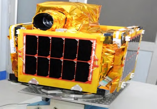
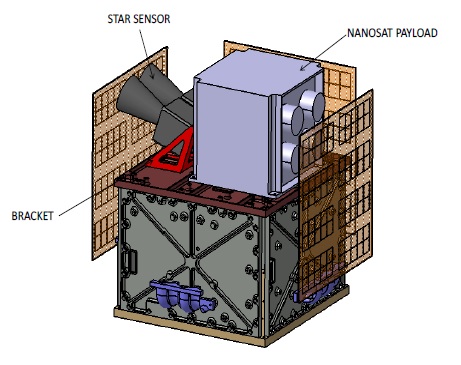
NIUSAT is 35 by 35 by 37 centimeters in size and employs a highly modular design in order to create a new small satellite platform that can be easily integrated with a variety of payloads for application in remote sensing, astronomy and communications.
This “Generic Nanosatellite Bus” can support payloads up to 30 x 30 x 15 cm in size with a power of up to 15 Watts. The overall design calls for robustness through redundancy with fully redundant power, command, attitude and communications systems with design simplicity arising through functionally co-located systems, e.g. facilitating EPS components like solar panel, battery and electronics on a single panel.
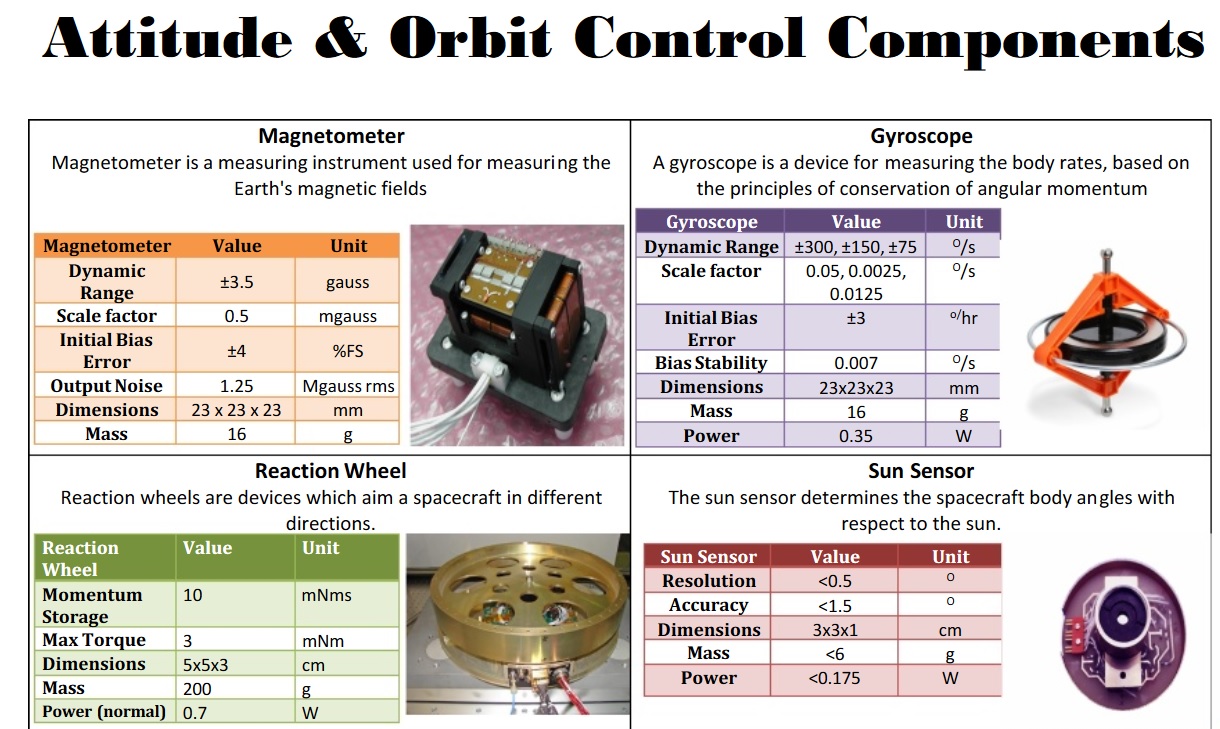
The spacecraft hosts four 24 x 24-centimeter deployable solar panels that generate up to 40 Watts of power, stored in a pair of 5 Amp-hour Li-Ion batteries. Three-axis stabilization is accomplished with sun sensors, magnetometers and MEMS gyros for attitude determination and miniature reaction wheels and magnetic torquers for attitude actuation.
The baseline attitude control system has a pointing accuracy of 0.5 degrees and provisions are available to add a pair of Star Tracker to improve attitude control accuracy to under 10 arcsec per a specific mission’s requirements. The platform can also host pulsed plasma thrusters to give the satellite the ability to alter and maintain its orbit.
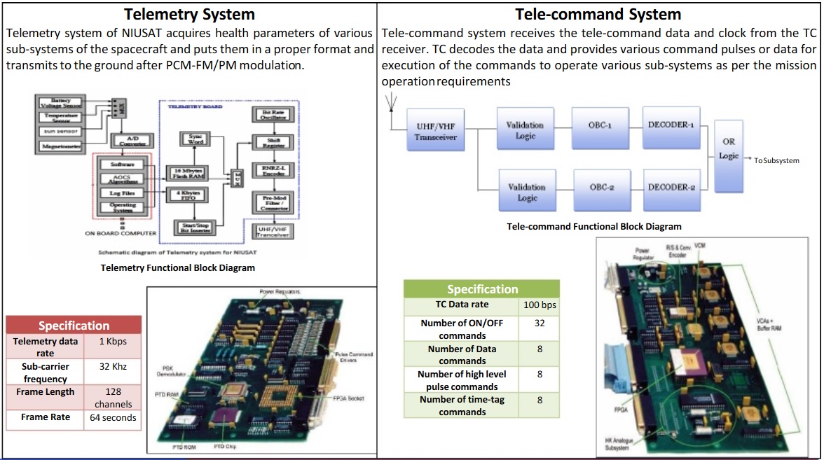
The satellite hosts a redundant Onboard Computer that is in charge of accepting and executing commands from the ground, controlling all satellite subsystems, deliver attitude actuation and process data coming from the payload.

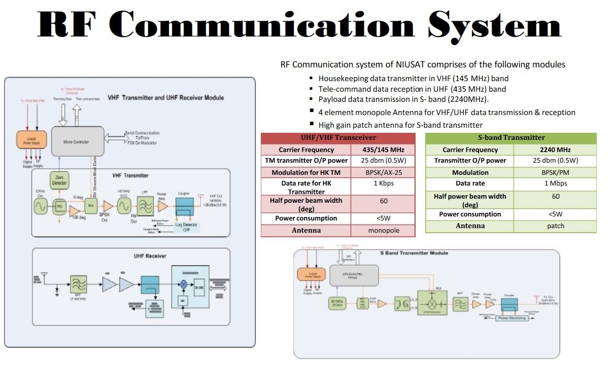
Command uplink and telemetry downlink uses the VHF/UHF bands while payload data is downlinked through a high-speed S-Band terminal to enable the satellite to downlink a sizeable payload data volume. The bus supports an internal data rate of 4Mbps with an onboard memory of 32GB and a downlink speed of 1Mbps.
NIUSAT hosts a payload known as the Miniature Wide Field Sensor (MWiFS) that collects ground imagery at a 25-meter resolution across a 50-Kilometer swath. MWiFS covers three spectral bands (Green – 520-600nm, Red – 620-680nm, Near IR 770-860nm) optimized for vegetation monitoring. The 10 x 10 x 25-centimeter instrument has a mass of 1.5 Kilograms and requires 8 Watts of power. MWiFS uses JPEG compression to comply with the data budget of the NIUSAT mission, featuring interfaces for I²C and CAN buses.
The primary objective of NIUSAT is the collection of photos for agriculture and disaster management support applications. One particular area of interest to be imaged on every pass is the Kanya Kumari District to study potential agricultural diseases of crops. NIUSAT also provides data for the Disaster Management Support (DMS) project to address disasters due to flood, cyclone, drought, forest fire, landslide and earthquakes. Imagery from the satellite can also be used to locate potential fishing zones around the coasts.
Looking further into the future, the NIUSAT project proposes the realization of a constellation of satellites, starting with a 4-satellite fleet with two medium-resolution imagers (30m), one high-resolution satellite (5m) and one satellite hosting a Synthetic Aperture Radar (20m). This constellation would enable 240 minutes of data downlink time and a revisit cycle for the Indian Territory of around one day. Further constellation options are placing up to ten satellites in a single orbital plane or establishing a two-plane system with eight satellites.