
Sentinel Satellites
The Sentinel Satellite Fleet is part of the Copernicus program – the European Commission’s Earth Observation Program formerly known as GMES (Global Monitoring for Environment and Security). Copernicus aims to achieve an autonomous and operational Earth observation capacity.
The program uses data provided by environmental satellites, and air & ground stations to provide a comprehensive set of land, atmospheric and oceanographic parameters in support of environment and security policy needs. Copernicus will be supporting six main branches of monitoring – land, ocean, emergency response, atmosphere, security and climate change. For that, the program relies on its space segment of observations satellites, and in-situ measurements using ground-based and airborne sensors. Data produced by Copernicus will be used by policy-makers.
The GMES program was initiated in 1998 by the European Commission and the GMES partnership between member states, space agencies and industry representatives was formed in 2001. The GMES Bureau was set up within the EU, Brussels, in 2006 and the GMES Fast Track Services and Pilot Projects were inaugurated in 2008 including Marine monitoring, Land monitoring, Atmosphere monitoring, Emergency response and Security. The European Space Policy recognized GMES as a European flagship mission next to the Galileo Navigation System – allowing in depth-studies for the space segment to commence.
For the initial phase of GMES, space-based data from current missions of ESA, EUMETSAT, and those of the ESA/EUMETSAT member states was used. To ensure the long-term sustainability of the operational program, GMES will establish its own dedicated space segment consisting of several satellites with different monitoring payloads. The project will become a part of the Global Earth Observation System of Systems for which it will provide data products and also have access to GEOSS data products.
In 2012, GMES was re-named Copernicus by the European Commission to honor the great European scientist and observer, Nicolaus Copernicus.
Deployment of the Copernicus satellite constellation began in 2014 using different launch vehicles including the Soyuz and Vega rockets operated by Arianespace.
The Copernicus satellite constellation will be known as Sentinel. The following spacecraft will be part of the constellation:
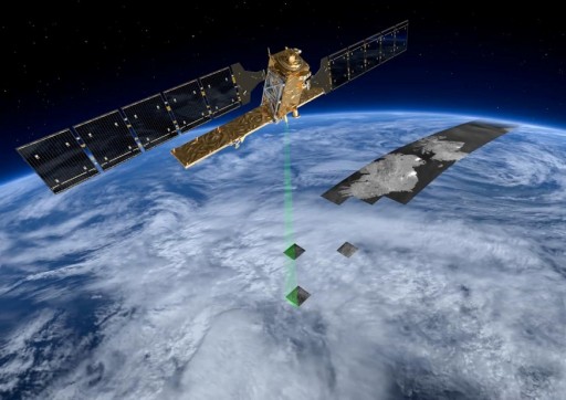
Sentinel 1: A pair of satellites equipped with a C-band interferometric Synthetic Aperture Radar to observe the sea ice zones, the arctic environment, the marine environment, land surface motion risks and to support mapping in support of crisis situations. The spacecraft will provide global coverage every 12 days delivering imagery with a high resolution of 5 by 20 meters.
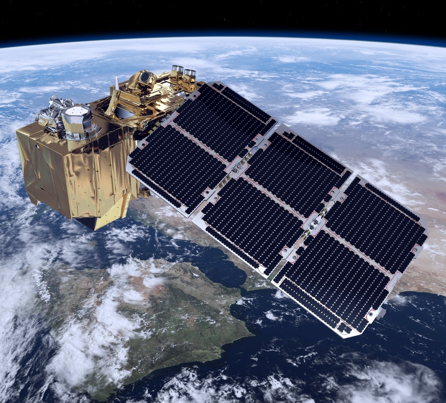
Sentinel 2: Two satellites carrying a multispectral optical imager to acquire imagery for land observation, vegetation monitoring, soil and water cover assessment, atmospheric observations and other data products to provide data continuity to the Landsat program and its European counterparts. The satellite carries a visible-near infrared imager covering a wide swath to ensure a re-visit time of 7 days.
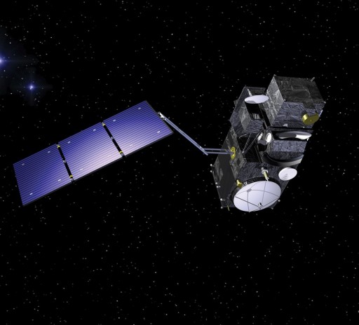
Sentinel 3: A pair of oceanography satellites carrying multi-payload packages to provide ocean observation data and land optical observation products. The satellites will collect ocean color, surface temperature, sea surface topography, land surface color, temperature and land ice topography data at a high revisit time of two days or less. Each Sentinel-3 spacecraft carries the following main payloads: OCLI (Ocean and Land Color Instrument), SLSTR (Sea and Land Surface Temperature Instrument), SRAL (SAR Radar Altimeter).
Sentinel 4: A payload to be launched on a Meteosat Third Generation Satellite, not an independent satellite. Sentinel-4 is a Ultraviolet-Visible-Near- Infrared Spectrometer that will also use data from a TIR (Thermal Infrared) sounder and MTG cloud imager that are part of the Meteosat spacecraft. It will provide data for atmospheric composition monitoring.
Sentinel 5: A payload to be launched on the MetOp Second Generation spacecraft consisting of a UV-VIS-NIR and Shortwave Infrared spectrometer and TIR sounder and imager.
Sentinel 5P: A precursor to the Sentinel-5 instruments to avoid data gaps between EnviSat and Sentinel-5, ensuring the availability of atmospheric data. The Sentinel 5P satellite covers air quality, climate change and stratospheric ozone and solar radiation.
Sentinel 6: The sixth Sentinel satellite will continue the precise ocean altimetry data provided by the Jason-2 and Jason-3 satellites.
