
Aleph-1 Satellite Constellation
The ÑuSat (Aleph-1) satellite series is operated by Argentinean company Satellogic for the collection of Earth image products to be made available on the commercial market. The Aleph-1 constellation will consist of up to 25 satellites, enabling rapid revisit times and a large daily imaging capacity.
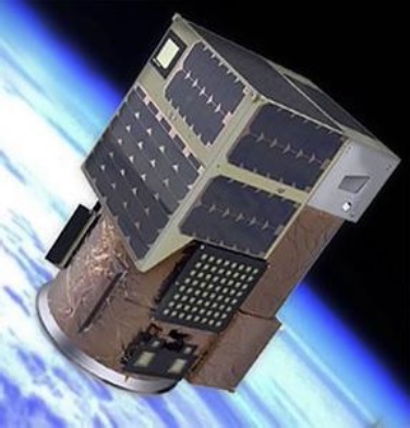
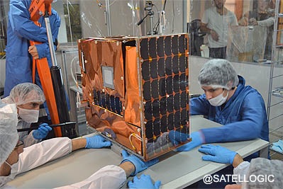
Developed and built by Satellogic S.A, the ÑuSat spacecraft are 43 x 45 x 75 centimeters in size and weigh 37 Kilograms. The microsatellite bus and its imaging payload were tested as part of the BugSat-1 mission launched in 2014.
The satellites carry an imaging system operating in the visible and near infrared spectrum, generating still imagery and video of Earth at a ground resolution of up to one meter. Data products will be available to commercial customers and a constellation of multiple satellites will provide short turnovers from the request of imagery to their delivery, also supporting rapid re-visit times.
The imaging payload carried by each Aleph satellite covers a wide spectral range to deliver a combination of high-resolution multi-band products as well as hyperspectral products at excellent spectral resolution.
The panchromatic imager delivers black-and-white imagery at a ground resolution of one meter; it is sensitive in the complete visible range from 400 to 900 nanometers. Multispectral imagery delivered by the satellite also had a one-meter ground resolution and covers five spectral channels (400-690, 400-510, 510-580, 580-690 for RGB and broad range imaging and a near-IR channel from 750 to 900nm). The multispectral imager also delivers imagery from a 5-Kilometer ground swath.
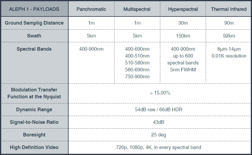
In addition to standard image products commonly offered by commercial Earth-Imaging Satellites, the Aleph satellites also deliver Hyperspectral and Thermal Infrared Data. The Hyperspectral Imaging Payload covers the 400 – 900nm visible range with up to 600 bands, creating a spectral resolution of 5nm, and a spatial resolution of 30 meters across a 150-Kilometer swath width. The Thermal IR imaging system collects data over a 92-Kilometer ground strip and is sensitive for wavelengths between 8 and 14 micrometers, delivering a ground resolution of 90 meters and resolving surface temperatures to 0.01 Kelvin.
In addition to still imagery products, Aleph-1 can deliver 720p, 1080p and 4K HD video for each of the four spectral products.
Each satellite, built for a three-year service life, collects up to 1,000 scenes per day with a data volume of around 50 MB per scene. The Aleph-1 satellites employ S-Band for command uplink and two X-band feeds, one at 8030 MHz using a custom protocol for 100kbps telemetry downlink and a high-speed DVBS-2 channel operating at 8050-8100 MHz for downlink of image products.
Satellogic advertises its data products for a wide array of applications including precise agriculture and food production, monitoring tasks within the oil and gas industry, cartography and urban planning, climate monitoring, resource management, disaster response, and infrastructure monitoring.
According to Satellogic, the first three Aleph satellites will be used as a Constellation Prototype, verifying the integrated system from data acquisition in space, data downlink to the ground, processing and distribution to users as well as quick tasking of the satellites to be able to respond to targets of interest.
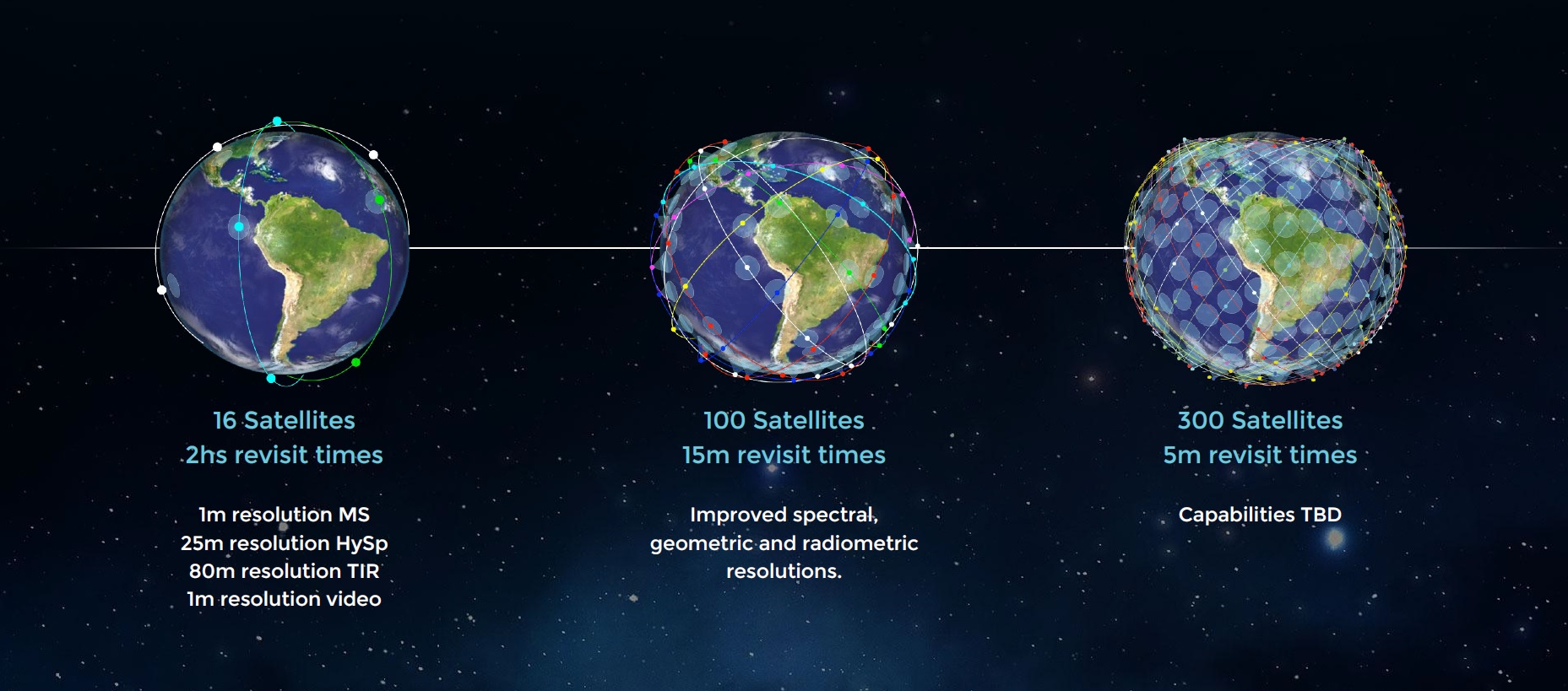
The operational 25-satellite constellation will achieve a 1.2-hour revisit time, equivalent to 20 intra-day scenes from a chosen location. Future constellation concepts presented by Satellogic call for 100 satellites to achieve a 15-minute revisit time along with improvements in spectral, spatial and radiometric resolution and autonomous processing chains for even quicker turnaround. A 300-satellite constellation planned in the more distant future could accomplish a 5-minute revisit time.
Founded in 2010, Satellogic S.A. is headquartered in Buenos Aires, Argentina from where company operations are managed. The Aleph satellites are manufactured at a facility in Montevideo, Uruguay, data processing is completed in Tel Aviv, Israel and sales departments are situated in different locations including the United States.
Satellogic launched its first satellites in 2013 when a pair of CubeBug Cubesats were launched as technology demonstration for some components of the company’s subsequent spacecraft. BugSat, nicknamed Tita, was the primary pathfinder for the Aleph constellation, weighing in at 22 Kilograms and hosting a mid-resolution camera system and amateur radio equipment.
The first two operational Aleph-1 satellites, named Fresco and Batata, launched as secondary payloads on a Long March 4B rocket on May 30, 2016 – riding with the Ziyuan 3-02 satellite into a 480 x 498-Kilometer Sun Synchronous Orbit at an inclination of 97.5 degrees. Aleph 1-3 is launched in June 2017 on a CZ-4B rocket alongside the HXMT space telescope and two smaller secondary payloads, headed into a non-synchronous orbit at an inclination of 43 degrees.
