
MKA-N 1 & 2
The Roscosmos Space Agency (now State Corporation) ordered a pair of MKA-N Earth Remote Sensing Satellite from Dauria Aerospace in December 2012, based on Dauria’s commercial Perseus-O satellites that were once expected to fly in 2015.
Dauria Aerospace is a multinational aerospace company specializing in providing global data, communication and remote sensing information acquired by space-based assets. Partnering up with Elecnor Deimos, the two companies announced in May 2014 plans to develop the Deimos Perseus constellation for frequent imaging of the entire Earth. The original plan called for the Perseus-O satellites to be built by Canopus Systems U.S., an independent affiliate of Dauria based in the United States.
The Perseus-O satellites were planned to be advanced & operational versions of the Perseus-M prototype satellites that launched in 2014 to test out the 6U CubeSat platform developed by Canopus. Perseus-O, in its original form, had to be abandoned in 2016 due to low funding, competition by U.S. companies like Planet, sanctions preventing cooperation between U.S. & Russian companies and low funding for the Russian side of the project. Also, Canopus Systems was closed down in 2015 and formed into Aquila Space (now Astro Digital) which is starting deployment of its Corvus-BC constellation in 2017, closely resembling the original Perseus constellation.
With plans for the original deployment falling through, Dauria Aerospace apparently partnered with South Korea’s SatByul Co. Ltd. to build and launch the Perseus-O constellation and the two MKN CubeSats for the Russian Government.
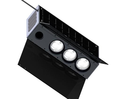
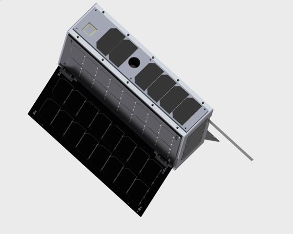
The MKA-N 1 and 2 satellites are essentially carbon copies of the Perseus-O 6U CubeSats for operation by the Russian government tasked with the collection of multi-band imagery of Earth at a ground resolution of 22 meters. Perseus-O was reported to have the capability of automatically identifying ground features such as crop types, their vigor and growing cycle.
The three-axis stabilized satellites, each 10 x 20 x 30 centimeters in size, host three similar imagers that are only distinguished by their spectral filters to collect imagery in the Landsat bands: green (520-600nm), red (630-690nm) and a near infrared band (770-900nm) using imagers with a 21.0 by 14.9-degree field of view to capture imagery across a 220-Kilometer swath with a nominal resolution of 22 meters. Acquired imagery is downlinked with a CubeSat-enabled Ka-Band terminal that allows for large data volumes to be downlinked on a daily basis.