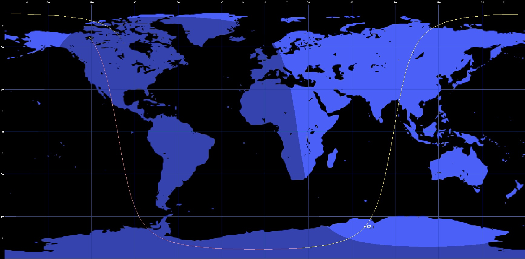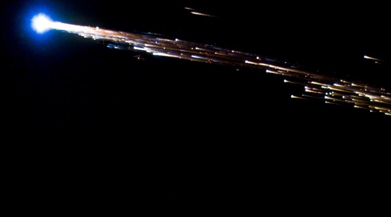
Re-Entry: Kuaizhou-1
NORAD ID: 39262
Origin: China
Object: KZ-1 – Kuaizhou-1
Type: Earth Imaging Satellite
Inclination: 96.5°
Launched: September 25, 2013 – 04:37 UTC
Launch Vehicle: Kuaizhou
Launch Site: Jiquan Satellite Launch Center, China
Re-Entry Prediction: September 1, 2015 – 4:33 UTC +/-12 Min.
Re-Entry Zone: Antarctica, Southern Atlantic, Indian Ocean
Satellite Description:
Kuaizhou is an integrated launcher-spacecraft system that can carry different payload packages to orbit with launches possible after less than half a day’s notice.
According to official Chinese media, the first KZ satellite was to be “used to monitor natural disasters and provide disaster-relief information for its user, the National Remote Sensing Center of China.” Information provided later by Chinese sources indicates that the KZ integrated launcher-payload system was being developed for reconnaissance, Earth observation, communications and other purposes.
The Kuaizhou-1 satellite was developed by the Harbin Institute of Technology and carried an optical imaging system using a CCD detector. From its low operational orbit, the satellite was planned to deliver panchromatic imagery at a ground resolution of 1.2 meters and perform multispectral imaging at a resolution of 5 meters. The spacecraft was reportedly capable of conducing off-nadir imaging up to 20 degrees.
Re-Entry Orbit