
NPP Spacecraft, Instruments, Mapping Techniques
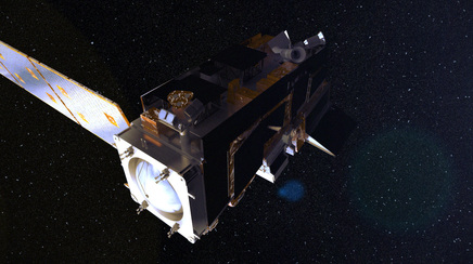
The NPP satellite is based on the Ball Configurable Platform (BCP) satellite design. This is a cost effective and flight proven design for remote sensing applications that can be built in less than 2 years. The BCP can support a variety of payloads and instruments. NPP will be the eighth of 11 spacecraft built by Ball Aerospace using the same core architecture. In total, this spacecraft design has logged more than 50 years of successful on-orbit operations. The BCP 2000 was designed to house payloads that require precision pointing control, high data throughput and downlink and require a controlled re-entry. NPP utilizes a redundant architecture to extend its on-orbit life time which is a design life of 7 years with a science mission duration of 5 years.
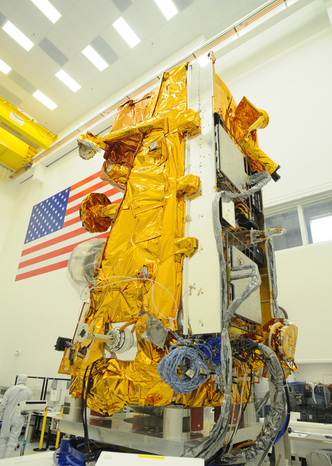
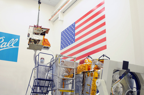
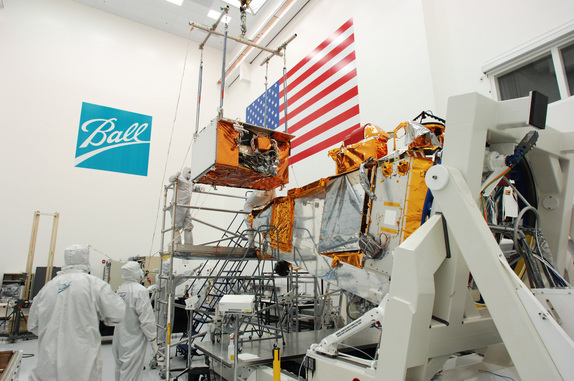
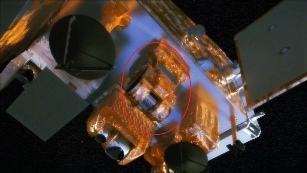
Ball Aerospace designed and built the spacecraft bus and integrated the instruments under contract to NASA’s Goddard Spaceflight Center. Ball is also responsible for tesing and launch support. The NPP Bus was completed in 2005 and underwent extensive risk reduction testing.
The Spacecraft has a mass of 4700 pounds and will carry about 800 pounds of propellant. Its payloads weigh approximately 1350 pounds. Power is provided by a single solar array which will be deployed shortly after launch. In total, the spacecraft will produce 2600W of power. NPP’s payloads require 630W of average on-orbit power. The communication system includes S-Band and X-Band Frequencies. S-Band systems provide Telementry downlink and Command uplink via NASA’s TDRSS (Tracking and Data Relay Satellite System) and the Svalbard Ground Station in Norway which is the main communication asset for the NPP mission providing an uplink capability of 128Kbps.
Playback telementry can be downlinked at up to 512Kbps and real time TLM requires up to 32KBps. X-Band Stored Mission Data (SMD) Downlink is supported to up 300Mbps. Data can be recorded while older data is played back. Onboard storage capabilities can record about 3.5 orbits worth of science data. Real Time downlink of mission data is also available to data users via High Rate Data of 15Mbps when the Satellite is in the Field of View of a ground receiving station. Attitude control is supported by a star tracker, gyros and reaction wheels. NPP is three axis stabilized. 2 sets of four thrusters are used for vehicle orientation and orbit adjusts. Those are powered by Hydrazine. The enhanced propulsion module also provides a controlled re-entry capability. Payload data systems include 1553 and 1394 data interfaces.
NPP’s instruments are based on intruments that flew on previous missions such as NASA’s Terra, Aura and Aqua Spacecraft as well as two missions of NOAA and DOD.
Science Instruments
Advanced Technology Microwave Sounder (ATMS)
ATMS is a cross-track scanner with 22 channels that provides sounding observations that are needed to retrieve atmospheric temperature and moisture profiles which are used for weather forecasting and climate monitoring. The instrument weighs about 75 kilograms and consumes 100W of power (200W peak). It was developed by Northrop Grumman.
ATMS includes channels from 23GHz through 183GHz and combines all the channels of its successful predecessors (AMSU-A 1&2, AMSU-B).
Cross Track Infrared Sounder (CrIS)
CrIS is a Fourier Transform Spectrometer with 1305 spectral channels that will produce hight-resolution and three-dimensional temperature, moisture and pressure profiles which will enhance weather forecating models. Long duration data collection will also improve knowledge on weather phenomena like El Nino and La Nina.
The instrument has a mass of 152 kilograms and is comprised of 6 assemblies – optical bench, scanning telescope, interferometer, PV focal plane arrays, 4-stage passive cooler and electronics assemblies. The optical bench provides a stable structure on which the other assemblies are mounted. The scanning telescope scans Earth views, the calibration target, and deep space. It focuses the IR Energy into the interferoemter which then breaks the IR Energy into spectral bands. This sequenced IR Energy is picked up by the PV detectors and it converts those into a corresponding electrical signal. Cooling for the sensors is provided by the 4-stage cooler. The electronics control the instrument and form the output signal from the electrical impulses that are provided by the science instruments. The output is then sent to the spacecaft for storage and downlink. Overall instrument data rates are about 1.5Mbps.
CrIS scans a 2200km swath width with 30 Earth scene views. Each scan also includes a view of the warm calibration point (an internal target) and the cold calibration point (a deep space view). Calibration for the interferometer is accomplished with Laser Wavelength calibration and Neon Bulb Spectral Calibration.
CrIS and ATMS continue the approach of monitoring weather conditions at both – infrared and microwave – frequency levels. Clouds are mostly opaque in inrared portions of the spectrum while they appaer transparent at microwave levels. Operating a system that detects and measures both makes it possible to cover a much broader range of weather conditions.
Data from CrIMSS (The systems complex that is consisitng of ATMS and CrIS) will be used for immediate numerical weather predictions. Lightly processed data are put into a complex computer model of atmospheric conditions that extrapolates the current weather into near future conditions. CrIMSS Data is only a small portion of that model because other data sources such as weather balloons and satellite observations also play are large role in getting a picture of atmospheric conditions. Sounders have had a large impact on forecasting accuracy. CrIMMS will continue this trend.
CrIMMS will also contribute to other fields in science and research. Geophysical research will be done by the sounders. The infrared sounder is accurate in providing global temperature and humidity distribution profiles as long as it is not too cloudy while the microwave sounder can be used to look inside or below clouds and provide a picture of the inside of storms like large hurricanes. Trace gases that play a large role in our ‘global energy budget’ (carbon dioxide and monoxide, ozone and methane) will be studied by CrIS and ATMS as well. CrIMMS data will be a part of climate research for which a very long observation period is needed. NPP will provide data over its lifetime that can be incorporated in past and future spacecraft’s data to study the evolution of global climate processes.
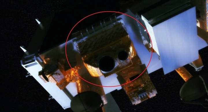
Ozone Mapper Profile Suite
VIIRS is a scanning radiometer that collects visible and infrared imagery and takes radiometric measurements of the land, atmosphere, Cryosphere and oceans. Data from the instrument will be used to measure cloud and aerosol properties, ocean color, sea and land surface temperature, ice motion and temperature, fires and Earth’s Albedo. VIIRS will contribute to improving understanding in global climate change. The intrument has a mass of 292 kilograms and requires 191W of power. VIIRS is a multi disciplinary device that provides data for oceans, land and cloud research as well as data for operational users. Sea Surface Temperatures that will be determinesd by VIIRS are classed as Essential Climate Variable. Two Day coverage is provided by the Spacecraft, allowing VIIRS to pick up highly variable concentrations of marine plants that is a major factor in ocean ecology. VIIRS provides a ground resolution of 750 meters. Shortwave infrared bands that are incorporated in VIIRS can be used for turbid water aerosol corrections. Coastal Zone Management will be supported with measurements of pigment concentrations, water clarity, suspended particulates and other properties in coastal regions. VIIRS will be utilized to forecast algal blooms, detect areas of high risk for coral bleaching due to tmeperature, assessing fish recruitement and ecosystem health.
Sea Surface Temperatures are also needed for hurricane predictions and weather forecsting. VIIRS will be monitoring the land surface on a regional or global scale as well. Four fields of science will be addressed by VIIRS: energy and water balance, vegetation dynamics, land cover change and the Cryosphere.
Cloud Science is another area that VIIRS will study. VIIRS will determine cloud cover height and various other properties such as thermodynamic phases of cloud layers (ice or water in the clouds) and micropohysical&optical properties that indicate the amount of water inside a cloud layer. Cloud data products will be used in a variety of communitites. Nowcasting models of clouds (up to 9 hours in the future) will be supported by VIIRS data and numerical (computer based) weather forecasting will also benefit from VIIRS data.
Clouds and Earth’s Radiant Energy System (CERES)
CERES is a three-channel radiometer that measures solar-reflected and Earth-emitted radiation from the top of the atmosphere to the surface of the planet. It will laso determine cloud properties including amount, height, thickness, particle size and phase of clouds using measurements by other instruments. These profiles will provide understanding in cloud-radiation, climate change and global warming predictions. The instrument weighs 45 kilograms and requires 45W of power. CERES was developed at NASA’s Langley Research Center.
It will measure Earth’s Energy Balance for a better understanding of climate change by studying Earth’s energy budget.
The Earth <> Atmosphere system is trying to maintain a balance between incoming energy from the sun and radiation that is emitted into space. Three different channels measure reflected sunlight (shortwave channel), Earth-emitted thermal radiation (longwave channel) and all wavelengths of radiation (total channel). To keep the system calibrated, a complex onboard calibration device is included in its design. Internal calibration using a solar diffusor, a tungsten lamp and two individual blackbodies that operate at different temperatures and cold space looks are performed during nominal Earth scans to keep CERES calibrated.
CERES’ global studies provide date for improving seasonal and internannual climate forecasts including cloud and radiative elements of climate phenomena. CERES will also be able to characterize the impact of natural disasters on global climate conditions. Long time climate variations and trends will be logged by CERES.