
Atlas V lifts Crucial Missile Warning Satellite to Orbit in Successful Year-Opening Launch
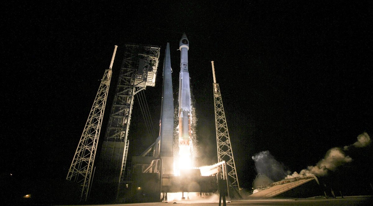
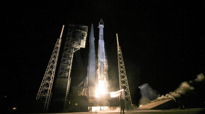
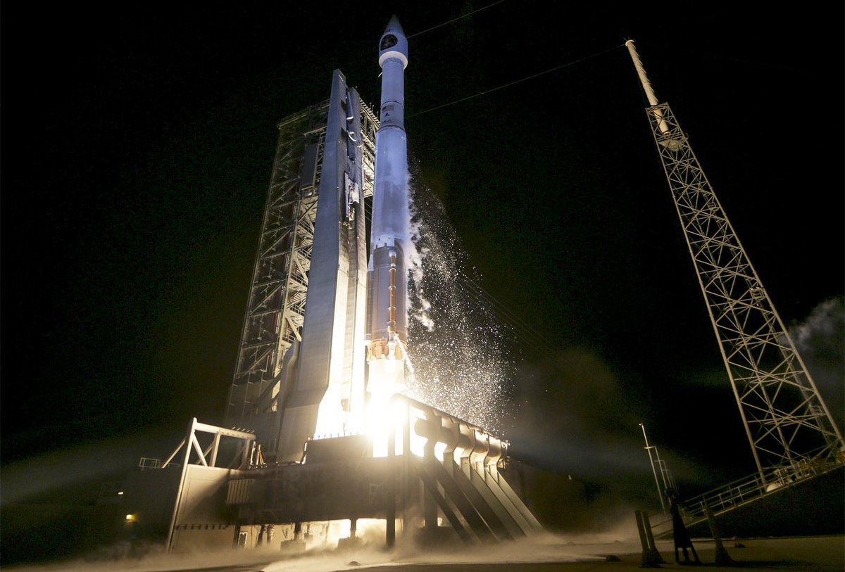
A United Launch Alliance Atlas V rocket thundered off from Cape Canaveral Friday night, carrying into orbit a critical missile warning satellite for the U.S. defense forces to keep watch over potentially dangerous missile launches affecting the U.S. homeland and forces stationed abroad.
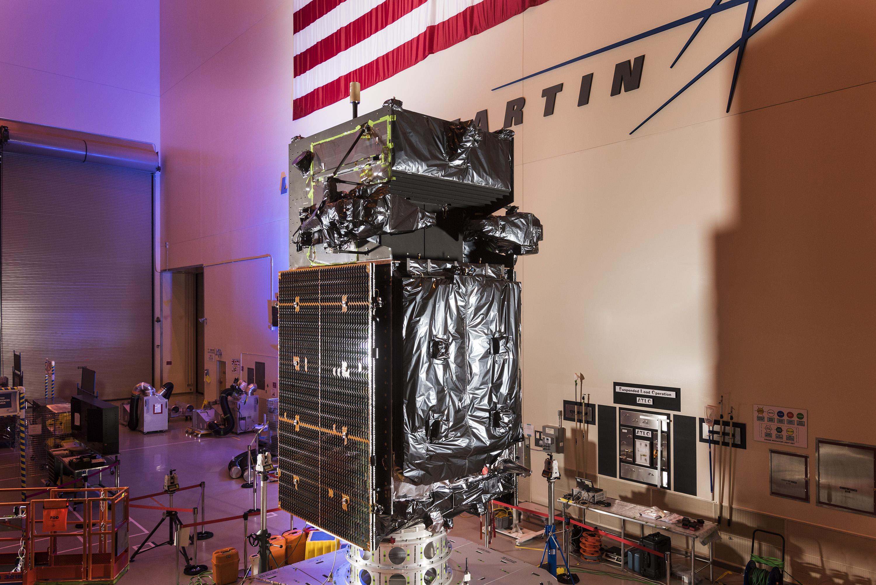
The 59-meter tall Atlas V rocket lit up the dark skies over Florida’s space coast at 7:42 p.m. local time, 0:42 UTC on Saturday, departing to the east-south-east to take into orbit the $1.2 billion SBIRS-GEO 3 satellite to join what is considered the Pentagon’s most important satellite program, enabling global missile detection and cutting in half warning lead times over the previous system.

Atlas V powered away from Cape Canaveral under the loud thunder of its Russian-built RD-180 engine, passing the speed of sound 80 seconds into the mission. The first stage dropped away just after the four-minute mark into the night’s mission, handing powered flight duties over to the trusted Centaur upper stage that was tasked with a pair of firings of its vacuum-optimized engine. Centaur first placed the stack into a preliminary parking orbit before lighting up again when passing over Africa to lift the 4.5-metric ton SBIRS satellite into a standard Geostationary Transfer Orbit peaking nearly 36,000 Kilometers above the equator.
SBIRS GEO-3 was sent off 44 minutes after liftoff, embarking on nine days of orbit raising operations to join the first two satellites in Geostationary Orbit to get one step closer to finishing the deployment of the Space-Based Infrared System later this year.
Friday’s Atlas V launch set a new record for the fastest launch campaign by the workhorse launcher – taking only 13 days from the arrival of the first stage at the launch complex to the rollout of the fully-assembled rocket. Continuing to streamline processing operations as Atlas V matures as a launch system, ULA can take advantage of the shorter on-pad time to provide more slots for missions in a calendar year.
Eight Atlas V missions are on the manifest for 2017, though there are still open slots that could be contracted by commercial satellite operators through ULA’s RapidLaunch initiative. Most of Atlas V’s business this year will be in support of national security and Friday’s mission was no different – lofting into orbit a valuable space-based asset for the Department of Defense.
The Space-Based Infrared System, SBIRS for short, is a cornerstone of America’s space-based defense assets, designed to detect and track missile launches to provide advance warnings of any imminent threat to the United States, deployed armed forces and allied nations. It is a successor to the Defense Support Program that went through several generations of satellites launched between 1970 and 2007.
SBIRS consists of dedicated satellites in Geostationary Orbit and hosted sensors in elliptical orbits which cover a blind spot of the GEO birds in the extreme northern regions. Friday’s payload is the third dedicated satellite, joining SBIRS-GEO satellites launched in 2011 and 2013, as well as three HEO sensors deployed on National Reconnaissance Office satellites launched in 2006, 08 and 14.

The early detection of incoming missiles is essential when attempting to intercept the attack before it reaches its destination. Initial systems deployed in the 1950s relied on ground-based radar with a very limited range, providing only short warning lead times.
As the utilization of space became possible, the United States initiated development of the Missile Defense Alarm System (MIDAS) that launched a number of satellites into Low Earth Orbit in the 60s, but failed to enter operational services as satellites either failed shortly after launch or never got into orbit. However, MIDAS was useful in demonstrating that the signatures of missiles could indeed be tracked from orbit.
The Defense Support Program was inaugurated in 1970 and went through three satellite generations operated from Geostationary Orbit to provide global missile detection capabilities using sensors that swept out a large viewing sector on Earth as the satellites spun around their central axis.
In the days of the Cold War, missile detection was focused on Intercontinental Ballistic Missiles while today, in a changing picture of worldwide security, short-range missile systems have become a real threat to deployed U.S. and allied forces – requiring ultra-sensitive sensors to pick up the faint-signatures of these types of missiles.

The SBIRS Program was formally initiated in 1996 to respond to changing threats by developing an integrated system that can detect all types of missiles and cut warning times in half compared to the DSP-based system. Lockheed Martin is the prime contractor for the SBIRS-GEO satellites with Northrop Grumman in charge of development and production of the SBIRS infrared-sensing instruments.
The SBIRS satellites are based on Lockheed’s popular A2100 satellite platform and each has a launch mass of around 4.5 metric tons, built for a 12-year service life. SBIRS satellites are outfitted with a pair of instruments – a scanning sensor and a staring sensor, both sensitive in three infrared bands in the short- and mid-wave range plus a see-to-ground channel. The scanning sensor progressively scans the entire visible disk of Earth to identify ICBM launches at fast revisit rate while the staring sensor can be kept focused on one or step between multiple areas of interest to spot faint & short-duration signatures from short-range missiles.

SBIRS can also detect other infrared events such as wildfires, volcanic eruptions and space debris re-entering the atmosphere in a blaze of fire.
>>SBIRS Space Segment Overview
The SBIRS-GEO 3 satellite launched on Friday is actually the fourth SBIRS spacecraft produced by Lockheed Martin. The launch order was swapped to allow the spacecraft built as SV3 to remain in storage and have SV4 launch right after finishing assembly and testing – reducing cost by eliminating the need to swap the spacecraft in an out of storage. SV3 will launch as SBIRS-GEO 4 later in 2017 to complete the core SBIRS constellation.
Given the importance of global missile detection and advance warning, the U.S. ordered another two SBIRS-GEO satellites from Lockheed Martin to ensure SBIRS-quality services can continue through the end of the next decade.
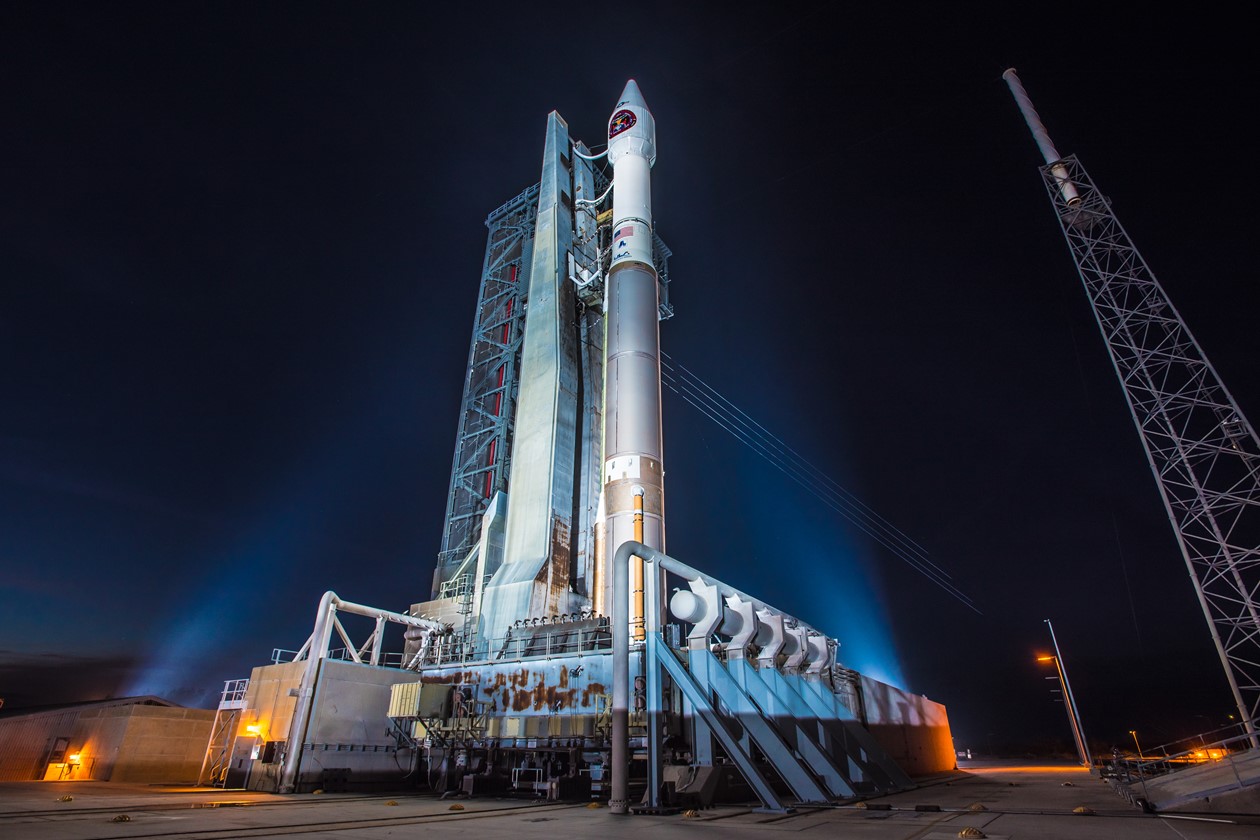
Like its two predecessors, SBIRS-GEO 3 utilized the Atlas V rocket as launch vehicle. Designated AV-066, Atlas V flew in its basic 401 configuration comprised of a two-stage stack, a four-meter payload fairing and no Solid Rocket Boosters. It marked the 69th Atlas V launch since the rocket’s debut in 2002 and the 34th flying in the 401 configuration that, by far, remains the most flown version of the rocket.
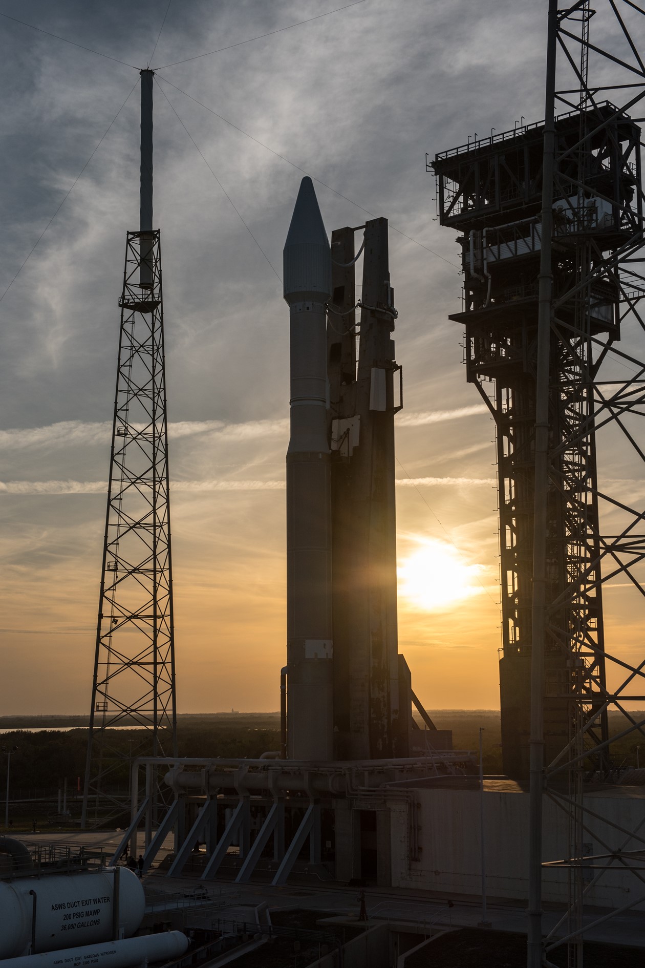
Rolled to its launch pad on Wednesday, Atlas V stood ready for liftoff Thursday night, but remained grounded after a technical snag pushed the launch time to the end of the window and the final attempt at picking up the countdown had to be halted due to a Customs aircraft violating the no-fly-zone around the Cape.
Coming back after a disappointing delay, Atlas V was ready for another seven-hour countdown procedure to get ready for a nighttime liftoff on its year-opening mission.
Following power-up of the two-stage rocket, teams put the Atlas V through a multi-hour testing campaign to exercise all critical subsystems while engineers buttoned up the launch facility to clear out in time for the busy propellant loading sequence.
Coming out of a scheduled hold at T-2 hours, Atlas V entered its 90-minute propellant loading sequence. The first stage had received its dose of 94,600 liters of Rocket Propellant 1 fuel after Wednesday’s rollout, leaving only cryogenics to be loaded during the countdown as well as helium tank pressurization gas. The first stage received 185,000 liters of -183°C Liquid Oxygen while Centaur was filled with 15,700 liters of the supercold oxidizer plus 48,000 liters of even colder Liquid Hydrogen, stored at -253°C. Tanking was by the book and Atlas V went through a second round of systems checks before entering final flight system reconfigurations and flight software load.
The countdown headed into a half-hour hold at the T-4-minute mark during which all tanks reached flight level and the SBIRS-GEO 3 satellite made its switchover to battery power with payload operators providing their final GO for launch to the launch team. With Atlas V standing fully fueled, illuminated by flood lights, teams went through a final Go/No Go poll to approve the 335-metric ton rocket to press into the highly choreographed countdown sequence.

When clocks resumed ticking at T-4 minutes, Atlas V started a fast-paced series of steps to be transitioned to a fully autonomous launch configuration – securing the rocket’s propellant tanks, switching to internal power, arming the Flight Termination System and handing control over to the onboard launch sequencer that oversaw the final pressurization of tanks and the ignition of the two-chamber main engine.
RD-180 rumbled to life three seconds before clocks reached zero, spinning up to a liftoff thrust of 390 metric-ton force under close observation by computers to ensure the booster reached operational conditions before being allowed to leave the ground.
Atlas V rose from its launch mount at 0:42 UTC, gently departing the ground in the usual slow initial climb-out of the 401 version of the Atlas rocket, lacking the kick of Solid Rocket Boosters that catapult the rocket’s bigger sisters of the ground.
Gimbaling the two nozzles of its main engine, Atlas V balanced in a perfectly vertical posture for the first 18 seconds of the mission before the pitch & roll program kicked in to put the vehicle onto a 95.9-degree launch azimuth, departing the Cape to the east-south-east. Lighting up the dark skies over the Space Coast, Atlas V quickly powered uphill, passing Mach 1 after eighty seconds and encountering Maximum Dynamic Pressure ten seconds later.

Burning 1,150 Kilograms of propellants per second, the first stage transitioned to closed loop control to dynamically adjust its flight profile after sticking to a fixed load-relief guidance profile for the initial portion of the mission when Atlas V was cutting through the dense layers of the atmosphere. While the first stage was still firing, Centaur prepared for its ignition by pressurizing the reaction control system and the RL-10C engine entered its final chilldown.
Heading into the thinner layers of the atmosphere, thrust on the RD-180 increased to 422 metric ton force before the engine was commanded into a gradual throttle-back to limit acceleration on the vehicle to 5Gs in the final seconds of its burn. BECO – Booster Engine Cutoff – occurred four minutes and four seconds into the mission after what was characterized as nominal performance on the first stage – meeting its cutoff target well within predicted margins.
Six seconds after BECO, the first stage was pyrotechnically separated and pulled away from the Centaur upper stage by firing eight small retrorockets. Upon separation from the booster, Centaur immediately purged its reaction control system and pre-started the RL-10C engine. Ignition of the RL-10C was confirmed at T+4 minutes and 20 seconds, soaring to 10,400 Kilogram-force of thrust to push the stack into orbit via a burn of eleven minutes and four seconds.
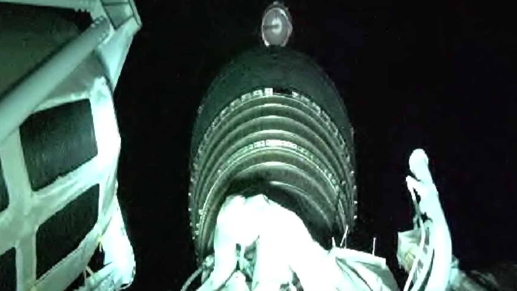
Ten seconds into the operation of the second stage, the two halves of the payload fairing split open and separated from the ascending rocket, revealing the SBIRS-GEO 3 satellite as aerodynamic forces were no longer a danger to the delicate satellite structure.
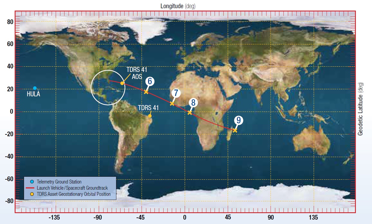
Centaur shut down its engine fifteen and a half minutes after launch, achieving an orbit of 175 by 1,230 Kilometers, inclined 26.8 degrees to either side of the equator. In this orbit, the upper stage was set for a coast phase of nine minutes and 37 seconds to continue flying to the south east, crossing the Atlantic and firing up again around the equator to that the high point of the injection orbit would also be located above the equator to ease the process of phasing the satellite into Geostationary Orbit.
RL-10C was re-started right at the T+25-minute mark on a planned burn of 3 minutes and 38 seconds, aiming to deliver SBIRS-GEO 3 into a standard Geostationary Transfer Orbit of 185 by 35,786 Kilometers, inclined 23.29 degrees. Achieved orbital parameters at separation read 185.1 by 35,822 Kilometers at an inclination of 23.289 degrees – marking another on-target injection by the Atlas V launch system.
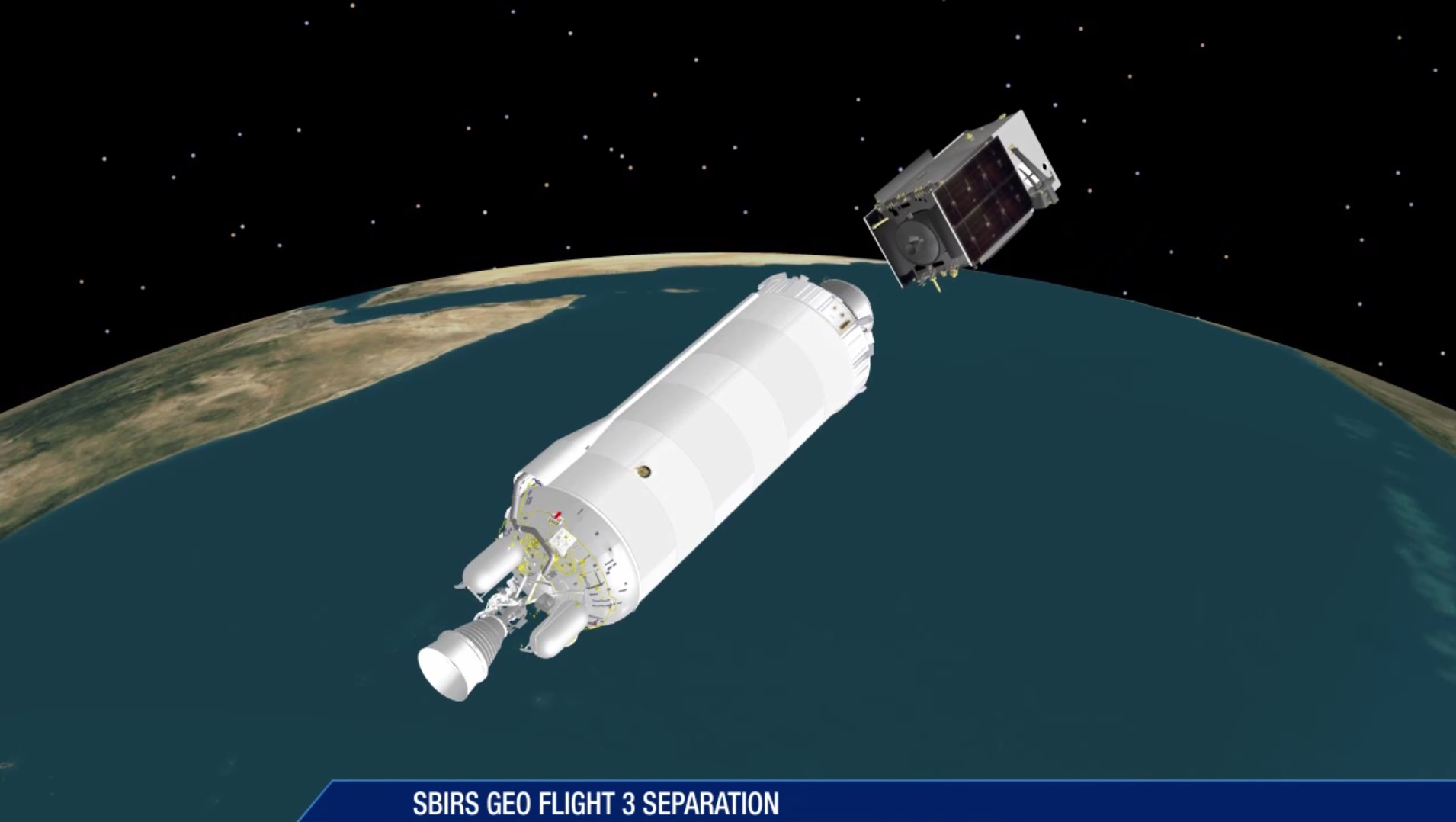
After the conclusion of the propulsive mission phase, Atlas V again entered coast mode, flying passively for 15 minutes while crossing over sub-Saharan Africa and the island of Madagascar, entering the proper attitude for satellite release. SBIRS-GEO 3 was sent on its way just shy of the T+44 minute mark over the Indian Ocean, just east of Madagascar – marking the successful completion of Friday night’s mission, ULA’s 116th launch success.
Following separation from its launch vehicle, SBIRS-GEO 3 will begin a nine-day sequence with six firings of its Leros main engine to lift itself into Geostationary Orbit, nearly 36,000 Kilometers above the equator where the satellite’s speed matches the Earth’s rotation so that the spacecraft can remain locked over one location. The Air Force did not disclose from where the new satellite will operate.
The next Atlas V mission recently slipped from a late January target to February 9 (UTC) due to an issue discovered on that rocket’s Centaur upper stage. Launching from California, Atlas V will be tasked with lifting the highly classified NROL-79 mission for the National Reconnaissance Office, believed to involve a pair of naval reconnaissance satellites.
SBIRS-GEO 4 is currently aiming for launch atop an Atlas V in November and another HEO sensor for the program may be headed into orbit in June aboard the NROL-42 satellite.
